Explosive Intensification for Hurricane Polo
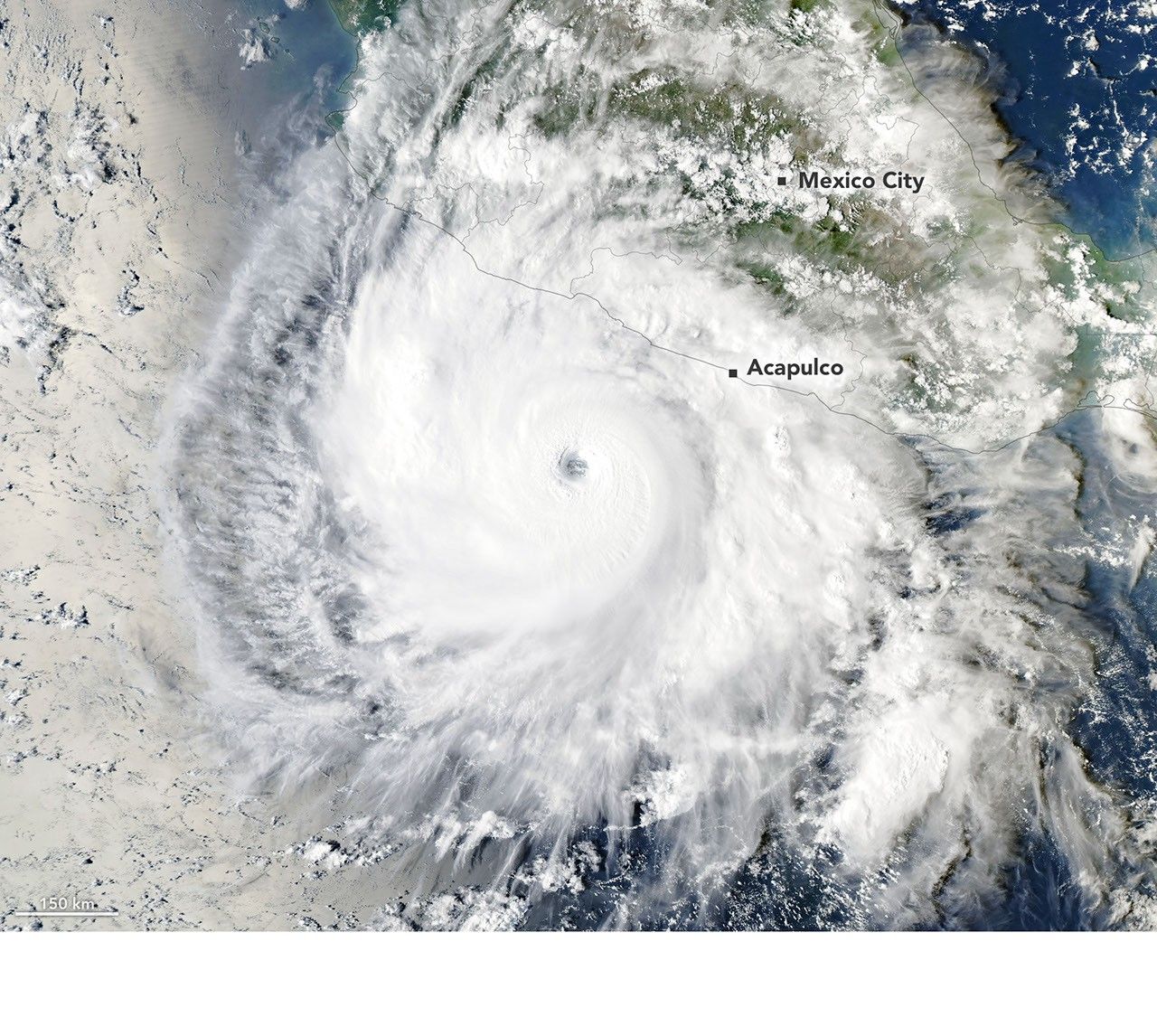
Polo began in mid-September 2026 as a tropical disturbance off Mexico's Pacific coast. It became a tropical depression by September 20 and a tropical storm the next day, then entered a period of rapid intensification that meteorologists described in unusually strong terms—'jaw-dropping,' 'astonishing,' and 'absolute insanity.' Gary Partyka of the Global Modeling and Assimilation Office at NASA Goddard called it 'explosively rapid intensification,' emphasizing 'This was RAPID, rapid intensification.' The environment was 'near perfect' for strengthening, with weak wind shear, high moisture, warmer ocean temperatures, and high atmospheric instability.
Observers noted extreme rapid intensification, a technical classification for wind speeds increasing at least 60 knots (111 km/h or 69 mph) in 24 hours. By September 22, Polo's maximum sustained winds had risen by 90 knots (167 km/h or 104 mph) in 24 hours and reached category 5. The National Hurricane Center called the intensification 'truly remarkable' in its forecast discussions. NOAA's Hurricane Hunter aircraft estimated winds near 285 km/h (180 mph) on September 22, which would make Polo the third-strongest eastern Pacific storm on record by maximum sustained winds and the fastest on record to go from tropical depression to category 5, according to some analysts.
On the afternoon of September 23, NASA's Aqua satellite, using MODIS, captured an image of Polo churning off Guerrero, southwest of Acapulco. By then, maximum sustained winds were 230 km/h (145 mph), category 4, after an eyewall replacement cycle weakened it slightly. Kristen Corbosiero of SUNY Albany, working on a NASA project using satellite data to study tropical cyclone ventilation, said the imagery was 'very impressive,' with a large, clear eye and extensive outflow pattern. She added that weak winds above the system and good outflow at the top contributed to the rapid intensification.
As Polo developed, it moved over sea surface temperatures as high as 32°C (90°F), 2 to 3 degrees warmer than usual for September 23. Surface waters across much of the region were above 27.8°C (82°F).