Bountiful Roebuck Bay
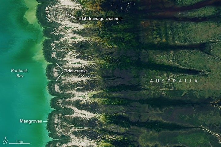
Roebuck Bay is a crescent-shaped feature in Western Australia's Kimberley region, shown here in a March 18, 2026, satellite image when water levels were high. This Earth Observatory Image of the Day also serves as the answer to the August Puzzler.
The bay's tides, among the clearest signs of the Moon's gravitational pull, can reach a remarkable 9 meters (30 feet). This is much larger than the 2-meter or less typical of many Australian coasts, and arises mostly from northwestern Australia's wide, shallow continental shelf, which amplifies tides as they approach shore. Rising and falling waters repeatedly inundate expansive mudflats, flood mangrove forests and salt marshes, and feed branching networks of tidal drainage channels.
Long-term Landsat observations show the green mangrove forests are dynamic, expanding westward by nearly 2 meters per year as sediment from eastern waterways accumulates in the sheltered bay. The evenly spaced, linear tidal creeks are likely not shaped by tides but by the regular spacing of linear dunes in the broader region. Seasonally, monsoonal rains from December to March transform the landscape into lush grasslands and wetlands, which then die back to gold and brown as the dry season begins around May and June.
The bay's dramatic tidal and seasonal changes support rich life: mangroves serve as nurseries for crustaceans and fish, while mudflats teem with snails, worms, crabs, clams, and cockles, reaching abundances of up to 2,500 per square meter. This bounty of marine life makes the bay a major draw for birds.