Europe's scorched landscapes seen from space after summer heatwaves
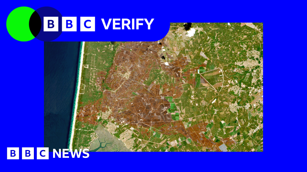
Satellite images from Copernicus Sentinel-2, examined by BBC Verify, show the effects of successive heatwaves since May across western Europe: shrunken glaciers, scorched wildfire zones, green fields turned arid, and lower river levels. The Palace of Versailles appears as an island of trees surrounded by brown fields. The EU's Copernicus climate monitoring service confirmed the hottest June-to-July period on record for the region. The immediate cause was persistent high-pressure weather systems, but climate change from fossil fuel burning has raised average temperatures for decades, making hot spells much more likely and intense.
Rivers have been hit hard. The Danube, Europe's second-longest river, dropped to its lowest levels in 30 years in several countries, exposing a mammoth's bones in Bulgaria and a sunken WWII warship in Serbia. Nuclear power stations in Hungary and Romania were forced to shut down or run at reduced capacity because they could not use river water for cooling. On the Rhine, cargo vessels were stranded and river cruises cancelled.
Alpine glaciers are retreating rapidly. This summer could become one of the worst ever recorded for melting, with more than a month of the season remaining. After a mild winter, glaciers had less snow cover than usual at the end of April, and an unusually early heatwave in May accelerated snow melt, exposing the ice beneath. Satellite imagery suggests the front of the Rhône Glacier in Switzerland has retreated by 50m (160ft) or more since last year. Glaciologist Dr Lander van Tricht said climate change has led to "much less snow in winter and much, much more melt in summer," and warned that if the trend continues, "the future looks very dramatic for the Alps."
Wildfires have also transformed landscapes, with more than 90,000 hectares (900 sq km) burned in France, according to the excerpt.