A Trio of Tropical Cyclones in the Pacific
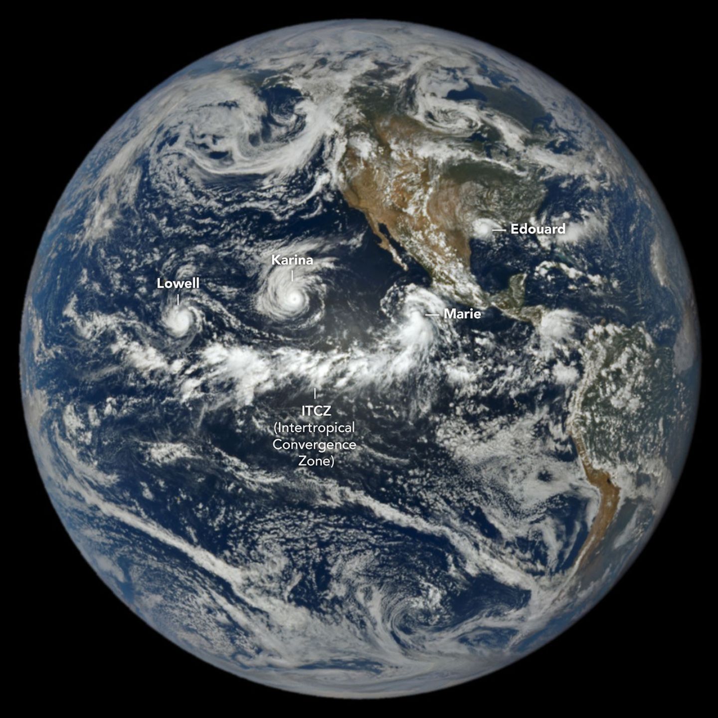
Spring 2026 hurricane outlooks predicted below-normal Atlantic activity but above-normal northeastern and central Pacific activity because of the brewing El Niño. By September 3, that forecast was playing out: the Northeast Pacific had produced 15 named storms and six hurricanes, while the Atlantic had only five named storms and no hurricanes. El Niño enhances Pacific storm activity through unusually warm ocean water and suppresses Atlantic activity by shifting large-scale circulation and increasing wind shear.
The image was captured at 1:14 p.m. Pacific Daylight Time (20:14 UTC) on September 1 by NASA's EPIC camera on the DSCOVR satellite, situated nearly 1 million miles from Earth and just shy of 93 million miles from the Sun. Besides the three Pacific cyclones, the image also shows Tropical Storm Edouard over Louisiana and Texas in the Atlantic, with a band of clouds and thunderstorms associated with the Intertropical Convergence Zone visible to the south.
The three Pacific storms were Lowell, Karina, and Marie. Lowell became the strongest, reaching category 5 strength for several hours on September 2. Karina, spinning a few thousand kilometers east, achieved category 4 intensity around the same time—a rare case of simultaneous category 4 and 5 hurricanes in the area. Marie, southwest of Baja California, was still a tropical storm in the image but strengthening as it moved northwest. Edouard, a short-lived Atlantic storm, had already made landfall and brought torrential rain and strong winds that downed trees and power lines; some areas received 15 to 24 inches (38 to 61 centimeters) of rain. As of September 3, the Atlantic basin's accumulated cyclone energy (ACE) index was 4.4—about 9 percent of normal—while the Northeast Pacific's ACE was 130, roughly 50 percent above normal, according to Colorado State University meteorologists.